


")
")
")


")
")
")
")
")
")

")
-150x150h.jpg)
-1000x1000-150x150.jpg)


-150x150.png)


There are no products to list in this category.
-
Exposed products
-
Bestsellers
 HotOverview The Mavic 2 Car Charger has a maximum output power of 80W, allowing you to charge batteries while driving. It features overheating protectio..69.90€Ex Tax:57.30€
HotMonitor Mount PRO for Inspire This is a CNC machined, aluminum mount that allows you to mount any 1/4-20 monitor on to your Inpire transmitter. Use it..59.90€Ex Tax:49.10€
HotDJI Ronin-M - Flat Facing Head Camera Screw 1/4" and 3/8" (2 pcs.) (PART16)..10.90€Ex Tax:8.93€
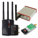
HotFusion Upgrade Amimon Connex Fusion allows the UAV operator a much more flexible choice between size and weight to multisystem enviroment.You can conn..1,183.90€Ex Tax:970.41€
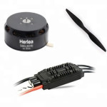
HotMio Damping is designed to match perfectly with the Mio gimbal and its payload where 8 silicone-filled rubber balls are used to further remove high-fr..222.90€Ex Tax:182.70€
HotAdicam Ball Mount System 75mm/100mm This set is made of aluminum which ensures high durability, stability and exceptional lightness. It is suitable fo..364.90€Ex Tax:299.10€
HotRSS Control Cable for BMCC is used to connect Remote Start/Stop Camera Port to BMCC cameras...9.90€Ex Tax:8.11€
HotConnect your IR-LOCK Sensor to the Cube autopilot. This cable provides I2C communication from IR-LOCK to the Cube via the Carrier Board, and also powe..9.90€Ex Tax:8.11€
HotThe most advanced 5.8GHz Video Transmitter available today. Only 4 grams, and a slender 31 x 20mm, the TrampHV is also the smallest direct LiPo-powere..42.90€Ex Tax:35.16€
Connect the communication ports on the Focus Remote Controller and the Osmo - X5 Adapter using the DJI Focus - Osmo Pro/RAW Adaptor Cable. Then, you c..43.90€Ex Tax:35.98€
DJI Focus - Data CableData Cable for your DJI FocusLength: 2mIn the box: 1x Data Cable..59.90€Ex Tax:49.10€
HotOverview The Mavic 2 Car Charger has a maximum output power of 80W, allowing you to charge batteries while driving. It features overheating protectio..69.90€Ex Tax:57.30€
HotMonitor Mount PRO for Inspire This is a CNC machined, aluminum mount that allows you to mount any 1/4-20 monitor on to your Inpire transmitter. Use it..59.90€Ex Tax:49.10€
HotDJI Ronin-M - Flat Facing Head Camera Screw 1/4" and 3/8" (2 pcs.) (PART16)..10.90€Ex Tax:8.93€
HotFusion Upgrade Amimon Connex Fusion allows the UAV operator a much more flexible choice between size and weight to multisystem enviroment.You can conn..1,183.90€Ex Tax:970.41€
HotMio Damping is designed to match perfectly with the Mio gimbal and its payload where 8 silicone-filled rubber balls are used to further remove high-fr..222.90€Ex Tax:182.70€
HotAdicam Ball Mount System 75mm/100mm This set is made of aluminum which ensures high durability, stability and exceptional lightness. It is suitable fo..364.90€Ex Tax:299.10€
HotRSS Control Cable for BMCC is used to connect Remote Start/Stop Camera Port to BMCC cameras...9.90€Ex Tax:8.11€
HotConnect your IR-LOCK Sensor to the Cube autopilot. This cable provides I2C communication from IR-LOCK to the Cube via the Carrier Board, and also powe..9.90€Ex Tax:8.11€
HotThe most advanced 5.8GHz Video Transmitter available today. Only 4 grams, and a slender 31 x 20mm, the TrampHV is also the smallest direct LiPo-powere..42.90€Ex Tax:35.16€
Connect the communication ports on the Focus Remote Controller and the Osmo - X5 Adapter using the DJI Focus - Osmo Pro/RAW Adaptor Cable. Then, you c..43.90€Ex Tax:35.98€
DJI Focus - Data CableData Cable for your DJI FocusLength: 2mIn the box: 1x Data Cable..59.90€Ex Tax:49.10€DJI Mini 3 Pro
![DJI Mini 3 Pro [image]](https://www.onedrone.com/store/image/cache/catalog/banners/dji_mini_3_pro_no_rc_-550x550w-200x120w.jpg)
- Less than 249 g
- Obstacle Sensing
- 4K/60fps Video
- 4K/30fps HDR Video
- 34-min Flight Time
- True Vertical Shooting
- FocusTrack
- MasterShots
- Timelapse
- and more...
-
Latest added
Latest
New1-Inch Large CMOS CameraWith a 50MP 1-inch CMOS sensor and f/1.8 aperture, Mini 5 Pro captures rich details and clean low-light shots. Compact in size..1,199.90€Ex Tax:983.52€
NewBetter Portraits & LandscapesOsmo Pocket 4’s 1-inch CMOS sensor and f/2.0 aperture ensure natural, clear portraits even in low light.Ultra HD Slow Mot..499.90€Ex Tax:409.75€
NewBetter Portraits & LandscapesOsmo Pocket 4’s 1-inch CMOS sensor and f/2.0 aperture ensure natural, clear portraits even in low light.Ultra HD Slow Mot..629.90€Ex Tax:516.31€
NewLightweight & Versatile, Compact Storage [1]The 11g [8] transmitter is ultralight and stylish with colorful covers [9]. The standard case (2 TX + 1 RX..33.90€Ex Tax:27.79€
NewLightweight & Versatile, Compact Storage [1]The 11g [8] transmitter is ultralight and stylish with colorful covers [9]. The standard case (2 TX + 1 RX..99.90€Ex Tax:81.89€
NewLightweight & Versatile, Compact Storage [1]The 11g [8] transmitter is ultralight and stylish with colorful covers [9]. The standard case (2 TX + 1 RX..79.90€Ex Tax:65.49€
NewLightweight & Versatile, Compact Storage [1]The 11g [8] transmitter is ultralight and stylish with colorful covers [9]. The standard case (2 TX + 1 RX..59.90€Ex Tax:49.10€
NewStunning Visuals in Every FrameWith a 1/1.3-inch CMOS sensor and f/1.7 aperture, Lito X1 captures rich daytime details and clean nightscapes.Pack Ligh..769.90€Ex Tax:631.07€
NewStunning Visuals in Every FrameWith a 1/1.3-inch CMOS sensor and f/1.7 aperture, Lito X1 captures rich daytime details and clean nightscapes.Pack Ligh..689.90€Ex Tax:565.49€
NewStunning Visuals in Every FrameWith a 1/1.3-inch CMOS sensor and f/1.7 aperture, Lito X1 captures rich daytime details and clean nightscapes.Pack Ligh..579.90€Ex Tax:475.33€
Stunning Visuals in Every FrameWith a 1/1.3-inch CMOS sensor and f/1.7 aperture, Lito X1 captures rich daytime details and clean nightscapes.Pack Ligh..419.90€Ex Tax:344.18€
8K Photos [4], Rich in DetailWith a 1/2-inch CMOS sensor, DJI Lito 1 captures up to 8K photos [4]. From action moments to serene landscapes, it preser..479.90€Ex Tax:393.36€DJI Mini 3 Pro
- Less than 249 g
- Obstacle Sensing
- 4K/60fps Video
- 4K/30fps HDR Video
- 34-min Flight Time
- True Vertical Shooting
- FocusTrack
- MasterShots
- Timelapse
- and more...
-
Bestsellers
-
Consumer
-
Pro / Enterprise
-
DIY (Components)
-
FPV Racing
-
Top Brands