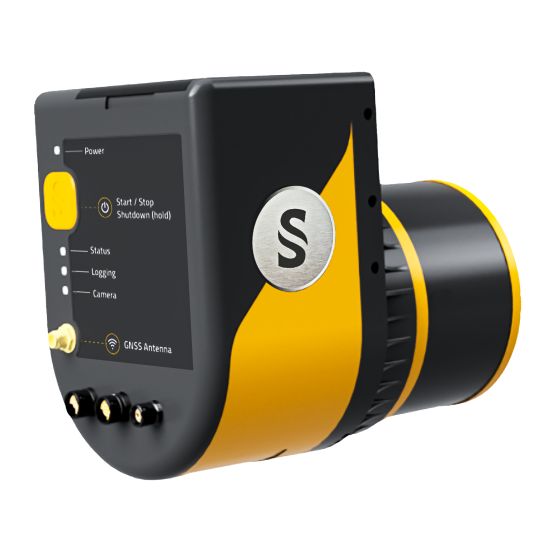
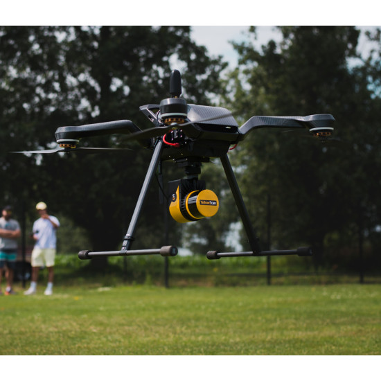
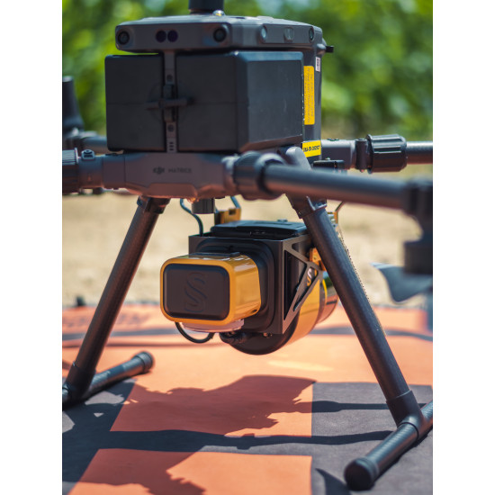


YellowScan Surveyor Ultra is a Hesai XT32M2X-based UAV LiDAR system.
The YellowScan Surveyor Ultra LiDAR system is suited for high speed UAV (VTOL fixed-wing or helicopter) and long-range needs due to its high-density specifications.
With the 360° Field of View of the Hesai XT32M2X laser scanner, the YellowScan Surveyor Ultra answers vertical mapping and mobile mapping needs when combined with Fly&Drive.
Its light weight makes it easy to mount on any UAV, including VTOL or helicopters. As with all YellowScan LiDAR systems, the Surveyor Ultra is designed for 3D modeling under vegetation, and fast data processing.
Poiščite izdelek, ki ga želite, in ga dodajte v košarico. Odprlo se vam bo okence, ki vam ponudi dve možnosti – da nakupujete naprej ali zaključite nakup. Izberite tisto, kar vam ustreza.
Ko boste izbrali vse, kar potrebujete, natančno preglejte košarico, nato pa kliknite na gumb »nadaljuj na vnos podatkov«. Izberite med opcijami: fizična ali pravna oseba. Najprej boste morali vnesti podatke, glede na to, ali ste fizična oseba ali podjetje. V primeru, da naročate oz kupujete kot pravna oseba, torej podjetje registrirano v Sloveniji kot tudi EU, velja da vnesete sledeče:
- Naziv podjetja
- Točen naslov podjetja
- Davčna številka
- Obvezna telefonska številka (dostavna služba)
Izberite način plačila:
- Po povzetju
- TRR
- Paypal
- Leanpay
Čisto na koncu pozorno preberite podatke o vašem naročilu in potrdite svojo izbiro.
V roku 1-3 delovnih dni bo paket prispel na vaš naslov.
Izdelke dostavlja dostavna služba GLS. Ob dostavi vas bo poklical dostavljavec dostavne službe GLS in se z vami dogovoril za prevzem paketa. Paket bo dostavljen na naslov, ki ste ga navedli ob naročilu.
Izbirate lahko med tremi načini plačila:
- Preko spletne banke oz. po predračunu
- PayPal*
- Plačilo po povzetju
- Lean pay
Če je vrednost paketa manjša od 50€, dostava po Sloveniji preko dostavne službe znaša 5,90€. Pri nakupu nad 50€ je dostava po Sloveniji brezplačna.
Znesek dostave se obračuna pri zaključku nakupa.
Žal se popusti in ugodnosti v naši spletni trgovini ne seštevajo. Ob naročilu lahko uporabite le eno kodo za ugodnost.
Če želite opraviti postopek vračila, vas vljudno prosimo, da izpolnete obrazec tukaj.
Če v 15 dneh od nakupa stranka ugotovi, da izdelka ne želi iz kakršnega koli razloga, izdelek prinese do nas v original embalaži, nepoškodovanega, NEAKTIVIRANEGA z računom. V takšnem primeru stranki vrnemo kupnino.
Če v roku 15 dni od nakupa stranka ugotovi, da je z izdelkom (dronom) karkoli narobe, izdelek prinesete do nas oz. vrnete v originalni emabalaži z vso vsebino, ki je bila v njej. V takšnem primeru stranki dron zamenjamo z novim. Vračilo izdelka je možno v originalni embalaži, nepoškodovano, z računom.
Po pretečenih 15 dneh steče garancijski postopek. Izdelek pošljemo na DJI pooblaščeni uradni servis. V roku 7-10 delovnih dneh prejmemo zamenjan izdelek.
Garancija prične veljati od aktivacije drona in ne od nakupa le-tega. Za uveljavljanje garancije ne potrebujete računa.
Servis pri pooblaščenem serviserju za DJI drone traja od 7-10 delovnih dni. Ker ima DJI visoke standarde varnosti , drone menjajo za nove in jih ne popravljajo.
Da, lahko se oglasite v naši prodajalni, kjer vam bomo z veseljem pomagli in predstavili izdelek.
Za izposojo izdelkov prosim pojdite na našo spletno stran: rent.onedrone.com/store oziroma se oglasite v naši prodajalni.
Kontaktirajte nas in zagotavljamo vam, da boste prejeli vse potrebne informacije.
Pokličite nas na številko: 041 688 150
Ali pa nas kontaktirajte preko e-pošte: info@onedrone.si

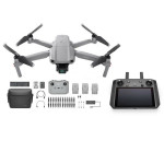
![DJI Mini 3 Pro [image]](https://www.onedrone.com/store/image/cache/catalog/banners/dji_mini_3_pro_no_rc_-550x550w-200x120w.jpg)

-150x150h.jpg)
-1000x1000-150x150.jpg)







-150x150.png)
