


")
")
![DJI Mini 3 Pro [image]](https://www.onedrone.com/store/image/cache/catalog/banners/dji_mini_3_pro_no_rc_-550x550w-200x120w.jpg)
")


")
")
")
")
")
")

")
-150x150h.jpg)
-1000x1000-150x150.jpg)


-150x150.png)
Reach calculates real-time coordinates with centimeter accuracy and streams them in NMEA or binary format to your device over UART, Bluetooth or Wi-Fi.


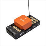
Emlid Reach M+ RTK GNSS + Hot Shoe + Tallysman Antenna
414.90€
Ex Tax: 340.08€
- Stock: Out of stock
- Model: REACHM+
13064 views
Reach M+ RTK GNSS + Hot Shoe Adapter + Tallysman Antenna
RTK GNSS module for precise navigation and UAV mapping without GCP
• Reach M+
• USB cable
• USB-OTG cable
• JST-GH 6-pin to jumper pin cable
• JST-GH 5-pin to jumper pin cable
• Hot Shoe Adapter
• Tallysman Antenna
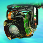
Reach M +
RTK GNSS module for precise navigation and UAV mapping
For detailed information, datasheets and deals please visit the website of general Laser og
RTK positioning for navigation reach calculates real time coordinates with centimeter accuracy and streams them in NMEA or binary format to your device over UART, Bluetooth or Wi-Fi PPK
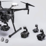
For UAV mapping
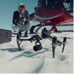
To Eternity accuracy without GCP reach module logs precise tracks and the exact moment when each photo is taken
Specifications
Mechanical:
Size: 56,4 x 45,3 x 14.6 mm
Weight: 0.7 oz (20 grams) Operating Tº: -20 to + 65ºC
Electrical:
Input Voltage on USB and JST GH
Connectors: 4.75 – 5.5 V antenna DC bias: 3.3 V
Average Current Consumption @ 5 V: 200 mA
Data:
Internal storage: 8GB
Correction Input: RTCM2, RTCM3
Solution Input: ERB, Plain Text, NMEA (RMC, GGA, GSA, GSV)
Logs: rinex2.x, rinex3.x GNSS
Signal: GPS/QZSS L1, Glonass G1, Beidou B1, Galileo E1, SBAS
Tracking Channels: 72 IMU: 9DOF update rate: 14 Hz/5 Hz connectivity
Wireless: Wi-Fi (802.11 a/b/g/n), Bluetooth (4.0/2.1 + EDR)
Interfaces: USB, UART, event positioning static: H: 5 mm + 1ppm, V: 10 mm + 2ppm Kinematic: Height: 7 mm + 1ppm, V: 14 mm + 2ppm

PPK for UAV mapping.
Centimeter accuracy without GCP
Reach module logs precise tracks and the exact moment
when each photo is taken.
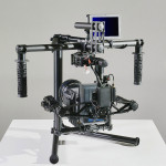
Why camera synchronization is so important?
Usually autopilot triggers the camera and records the coordinate it has at the moment. When the drone is flying at 20m/s and GPS works at 5Hz, that means your autopilot will have position readings only each 4m. While enough for navigation such readings are not suitable for precise georeferencing. Also, there is always a delay between the trigger and the actual moment the photo is taken. Reach module solves this by directly connecting to the camera hot shoe port which is synced to the shutter. The time of each photo is logged with a resolution of less than a microsecond.


Connect Reach to a hot shoe port on a camera
Every time a photo is taken camera produces a pulse on a flash hot-shoe connector which is synced to a shutter opening.

Fly a drone, Reach will record photo events
Reach captures flash sync pulses with sub-microsecond resolution and stores them in a raw data RINEX log in internal memory.

Download logs from Reach and base station
After the flight get the RINEX logs from your airborne Reach module and a base station (Reach RS, CORS or other receiver).

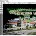
Process logs and get a file with geotags of photos
Process RINEX files using the free RTKLIB software. Produced file with precise coordinates of the photos can be used for georeferencing.
ReachView app


